Collaborative Effort with NASA Langley Research Center
15 May 2005 – present
Collaborator: David L. Raney
Supported by:
Texas Institute of Intelligent Bio-Nano Materials and Structures for Aerospace Vehicles (TiiMS) and NASA Langley LAARS Program
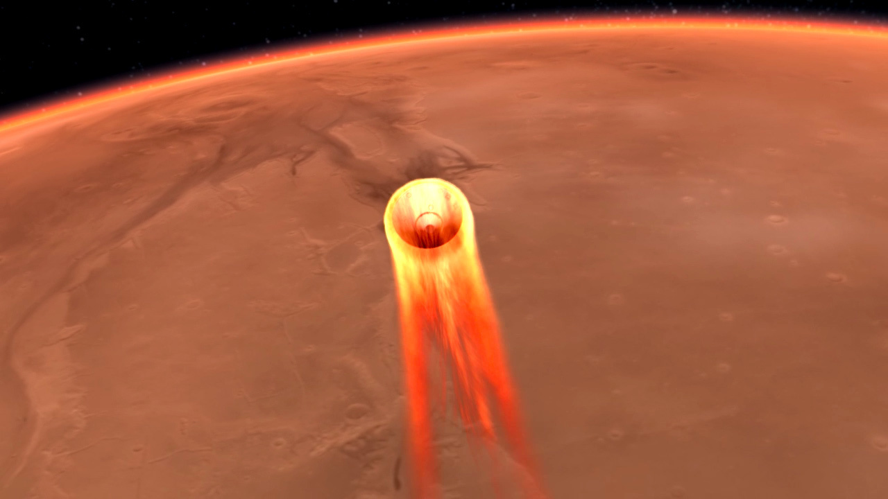
The NASA Exploration Initiative Spiral 2 exploration mission architecture involves heavy reliance on both manned and unmanned landers to pre-position and then leverage assets on the lunar surface.
This research is seeks to develop an Optionally Autonomous Surface Intelligence System (OASIS) to provide a pinpoint landing and hazard avoidance capability for both manned and unmanned landers that could operate on either the lunar or martian surface, to support Spiral 2 and follow-on Exploration Mission activities. The OASIS Project would develop a dynamic cost map-based guidance and control system along with a variable-autonomy interface for optional pilot control of descent and landing. These systems would be integrated with a real-time terrain mapping/hazard detection sensor to generate surface feature data for the formulation of the guidance cost map.
Crossrange and downrange maneuvering during the terminal landing phase is generally expensive in terms of propellant budget. To minimize the need for corrections during the final landing phase, the OASIS project will develop active control for early phases of reentry where minor guidance corrections and energy management maneuvers are highly leveraged. Additionally, the potential to actively control the descent path while the vehicle is on the chute will be investigated for Mars landers. Although steerable parafoil chute systems have been demonstrated on earth, such systems will pose novel dynamics and control challenges when scaled appropriately for the martian atmosphere. Finally, the OASIS Project will include a capability for real-time precision resolution of lunar/martian surface features to enable high precision terrain-based navigation to the final landing site during the terminal flight phase.
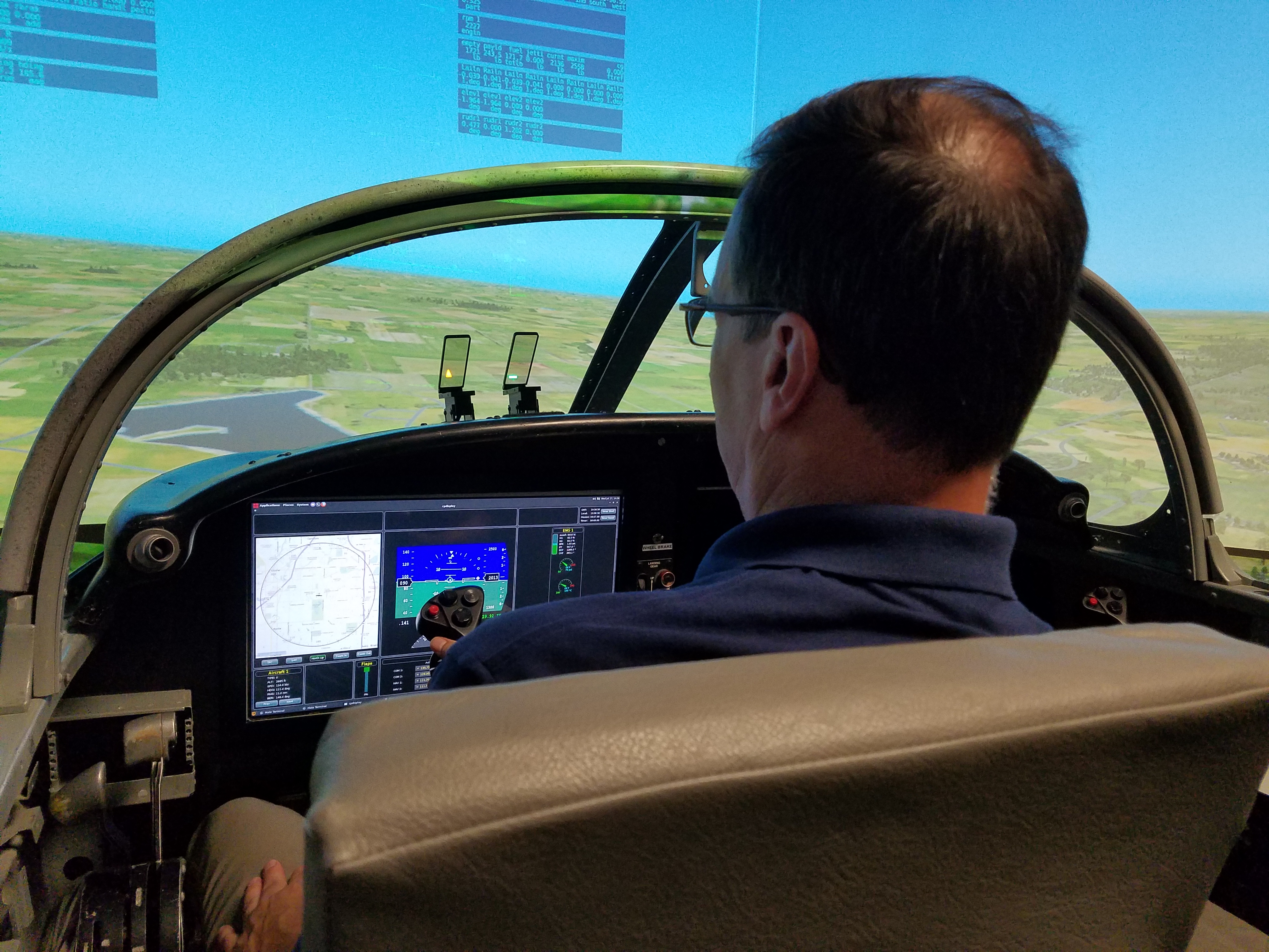
Variable autonomy will be a major research focus since manned landers will require the ability for human monitoring and optional intervention via an operator interface that is both intuitive and flexible. The OASIS Project will develop and implement a human-machine interface system that relates terrain hazard information and precision guidance through tactile, auditory, and visual cues, enabling the human to continuously elect a level of interaction that ranges from pure oversight to full manual control.
The high value of assets on board the lander will necessitate active detection and avoidance of surface hazards including large rocks, crevasses, and excessively rough or inclined terrain. The OASIS Project will develop a hazard-avoidance cost mapping algorithm that provides information to the lander’s terrain-based guidance and navigation system. This function will utilize data from the high precision surface feature resolution sensor suite.
Unprecedented landing precision will be required to complete the Spiral 2 activity. Historically, the touchdown precision of current entry, descent and landing systems ranges from approximately 3 km at best to tens of km in some cases. By contrast, the required precision for missions that leverage pre-positioned assets will be on the order of tens of meters. The OASIS Project will develop a system to provide active control through all phases of entry, descent, and landing to enable the required degree of landing precision.
Specific tasks and research objectives:
- Acquire, modify, and host representative simulation model of manned lander.
- Acquire and implement relevant atmosphere and terrain models for lunar and martian landing scenarios.
- Develop and implement algorithms for fault tolerant control during early entry phases to enable high precision touchdown site acquisition.
- Investigate potential for control on chute to reduce propellant requirements for high precision Mars landing.
- Develop and implement active hazard detection sensor models and lander guidance cost mapping algorithms
- Develop hazard avoidance and precision landing cueing interface for piloted lander simulation.
- Integrate cost mapping guidance with piloted lander cueing interface.
Working with me on this program is Graduate Research Assistant:
- Theresa Spaeth